


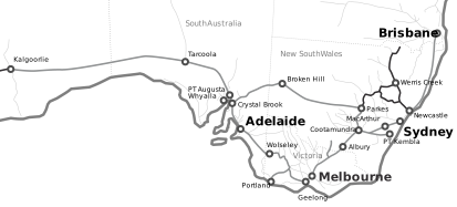
To access information relating to the Hunter Valley corridor line segments select a book number or diagram link from the table below.
NOTE: Network Information Books must be used in conjunction with these diagrams for more detailed operational information. Do not rely solely on these diagrams.
| Network Control Board | Area Covered | Book Number | NIB Diagrams | Line Diagram | Posted |
|---|---|---|---|---|---|
| Port Waratah | Islington & Port Waratah (inclusive) to Sandgate (exclusive) | OGW-30-14 | NIB Diagrams | Line Diagram | 26 Jan 2024 |
| Kooragang | Sandgate (exclusive) Kooragang Island (inclusive) | OGW-30-13 | NIB Diagrams | Line Diagram | 26 Jan 2024 |
| Lower Hunter | Sandgate (inclusive) to Allandale (exclusive) Telarah & Bloomfield Branch line (inclusive) | OGW-30-15 | NIB Diagrams | Line Diagram | 08 Jun 2023 |
| Middle Hunter | Allandale (Inclusive) to Singleton (inclusive) Mt Thorley – Bulga – Wambo Branch lines (inclusive) | OGW-30-16 | NIB Diagrams | Line Diagram | 25 Jan 2024 |
| Upper Hunter 1 | Singleton (exclusive) to Mangoola (exclusive) and Aberdeen (exclusive) | OGW-30-17 | NIB Diagrams | Line Diagram | 24 Apr 2024 |
| Upper Hunter 2 | Aberdeen (inclusive) to Werris Creek (exclusive) | OGW-30-18 | NIB Diagrams | Line Diagram | 29 Nov 2023 |
| Hunter North | Werris Creek (inclusive) to Turrawan (inclusive) | OGW-30-20 | NIB Diagrams | Line Diagram | 07 Aug 2023 |
| Hunter North West | Goobang Junction (exc) to Dubbo (exc) and Turrawan (exc) to North Star (inc) & Camurra West | OGW-30-23 | NIB Diagrams | Line Diagram | 29 Feb 2024 |
| Upper Hunter 3 | Mangoola (inclusive) to Gulgong (exclusive) | OGW-30-19 | NIB Diagrams | Line Diagram | 26 Jan 2024 |
| Hunter West | West Dubbo (inc) to Gulgong (inc) via Merrygoen & Merrygoen to Werris Creek / Gap (exc) | OGW-30-24 | NIB Diagrams | Line Diagram | 05 Oct 2023 |
For further information or to advise of minor discrepancies in these documents please email configmanagement@artc.com.au